These photos are then processed to make a panoramic view to provide a feeling of being at that place. Due to privacy matters, faces and vehicles registration plates are blurred during the process.
Launched in May 2007, Street View for Google Maps brought huge excitement to users around the world. Initiated from Google’s home country US, covering various cities & territories one by one, it is now covering nearly half of the world with its 26th update on 8th June.
For rest of the world with no Street View coverage, the only option was to wait. But with latest enhancement in photos layer for Maps which is mainly sourced from Panoramio as well as from Flikr has provided a great work-around to Street View. At these sites, photos are uploaded by their owners and then geo-tagged according to their focused shoot.

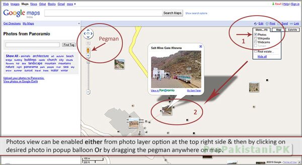
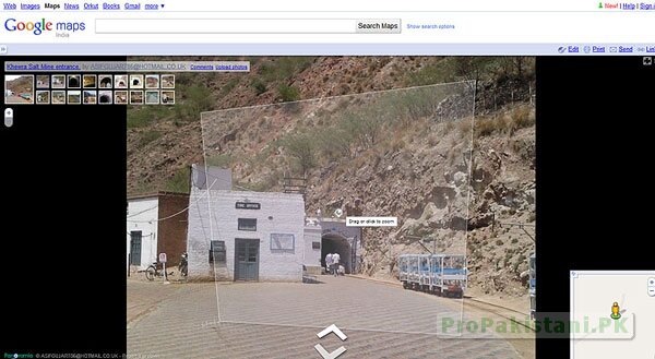
Photo layer has also been linked with Street View’s famous Pegman. Dragging the Pegman on the map or clicking on any photo in enabled layer of photos will turn maps into user photo viewer along with optional drag arrows around the picture where available depending upon number of pictures available for that particular place.
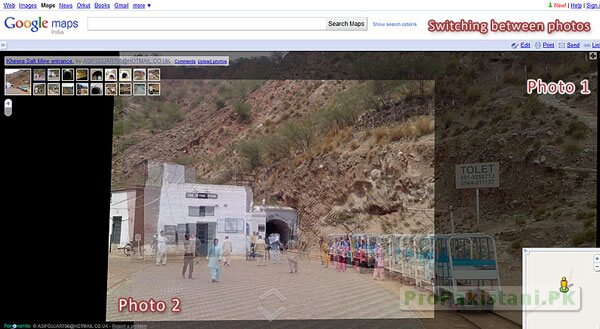
More the number of pictures available at a place, more ecstatic experiences are guaranteed. The photos have been arranged in a state of the art manner that actually provides a great Street View look. Dragging around and jumping from one picture to another is just as it appears in Street View.


To experience this, have a look at following video.
There are no privacy terms over these photos, hence no blurring of faces or registration plates. As all these photos are made available by users at Panoramio or Flikr, they have complete control to take care of their privacy before they or anyone else put them to public.
A private marked picture only appears as icon but in an enlarged public view, it appears as dark screen with a not available message. The bottom left side provides the source of picture while top left side provides the list more available pictures for the particular place along with owner’s detail.
Since map data is publicly made available for Pakistan by Google through their user contributions at Google Map Maker project, Pakistani people have been seen more engaged with use of maps in their routine life. The related features intend to get a boost as well in practice as soon as they are enhanced & available e.g. Google maps driving directions for Pakistan and so this new feature could be another interesting point of making the best usage of publicly available maps, such as creating your own street view for tourism support for your local area or even for small businesses.
The panoramic views of Street View enabled not only thousands of people around the world to enjoy remote visits to places where they can not physically go but it has helped a lot in growth of economy and businesses in many ways and so this work-around feature should be taken in utter significance to make a best use and growth of businesses.
No comments:
Post a Comment